GoSuite: One Agent, Every Tool
RASID’s end-to-end agentic platform: GoPilot plans the work, GoServers supply the tools, GoBase supplies the knowledge and GoDoc parses the documents, with only the tools a task needs loaded into each request.
Product Platform · Agentic Suite · AI
The problem
Earth-observation data is abundant, but turning a question into an answer still takes several tools and data scattered across formats, folders and services. Handing that job to an LLM agent naively is expensive: loading every tool definition into every request burns tokens, slows the agent down and makes the choice of tool harder as the catalogue grows. The cost ends up scaling with the size of the toolbox rather than with the difficulty of the task.
The suite
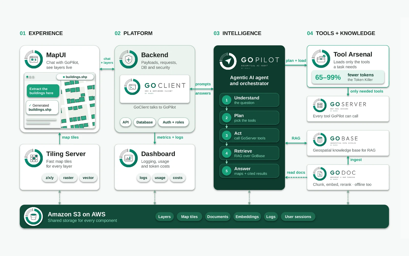
GoSuite is RASID’s end-to-end platform for agentic work. GoPilot sits at the centre as agent and orchestrator, and around it sit GoServer tools, GoBase knowledge and GoDoc document intelligence. Four layers make up the suite: an experience layer, with the MapUI chat interface and a tiling server that serves every layer as fast map tiles; a platform layer, with the backend, API, database, authentication and roles, plus the GoClient SDK and notebook client; an intelligence layer, which is GoPilot itself; and a tools-and-knowledge layer. All four read and write the same storage on AWS.
GoPilot, the orchestrator
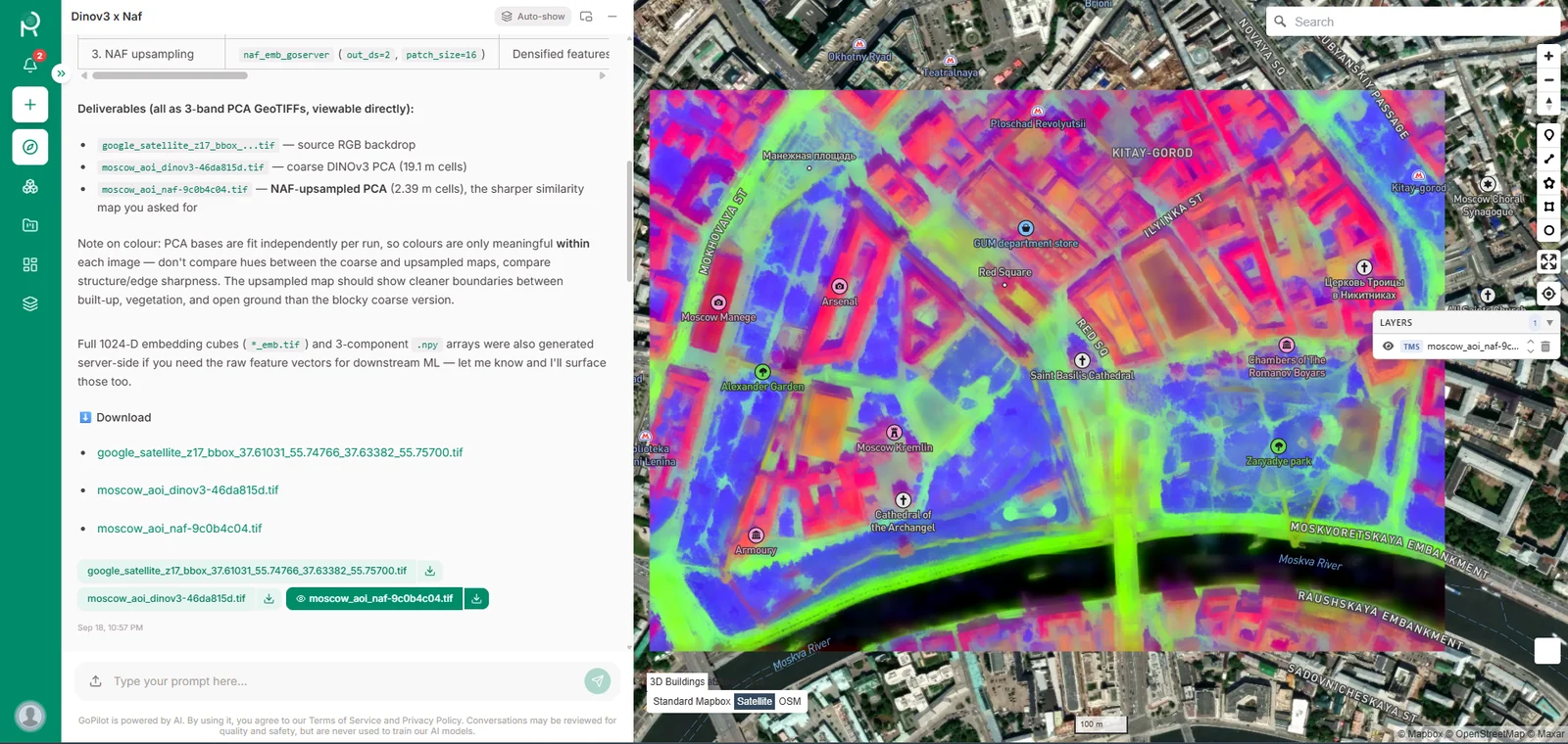
Every request runs the same five steps: understand the question, plan which tools are needed, act by calling GoServer tools, retrieve supporting knowledge from GoBase, then answer with maps and cited results. GoPilot is built on AWS Bedrock and the Strands agent framework, with Claude as the reasoning layer. It does not replace specialised geospatial models, it orchestrates them: vision workflows call models such as SAM3 and DINOv3, and the agent is responsible for sequencing the work rather than for the science inside each step.
The tool arsenal
The arsenal is what makes an agentic suite affordable to run. Instead of exposing the whole toolbox on every call, GoPilot plans the task first and loads only the tools that plan requires. In practice this cuts token costs by 65 to 99% against loading all tool definitions up front, which is why the team calls it the token killer. Fewer irrelevant tools in context also means fewer wrong turns, so the gain shows up in latency and reliability as well as in spend.
The tools: GoServers
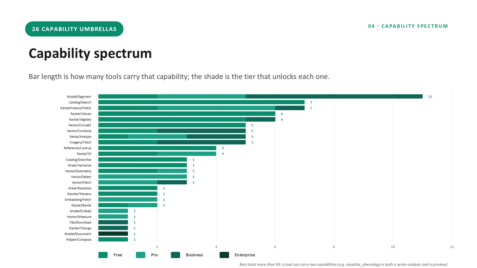
The tools themselves live in GoServers, RASID’s MCP tool servers: GoServer-Fetch for data retrieval, GoServer-Geo for vector operations, GoServer-Analyze for raster and time-series analysis, and GoServer-AI for model inference. Because they speak the Model Context Protocol, the same tools GoPilot orchestrates can be called directly from other agents or from a client’s own code. Between them they reach more than 10,000 datasets and hundreds of models, including Sentinel-2, high-resolution optical imagery, digital elevation models, ERA5 climate reanalysis and foundation-model embeddings such as Clay and AlphaEarth.
The knowledge: GoBase
GoBase is the geospatial catalog GoPilot retrieves from. It indexes a whole data lake, raster, vector, documents, spreadsheets, images and video, into one queryable spine with a natural-language layer on top, and serves it back to the agent as retrieval-augmented generation, so an answer can cite the file, the page and the passage it came from. GoBase is a product in its own right and has its own case study; inside GoSuite it is the component that stops the agent guessing when the answer already exists in the client’s own data.
Document intelligence: GoDoc
GoDoc is the parsing front door. It chunks, embeds and reranks documents and maps, then ingests the result into GoBase, and GoPilot can also read documents through it directly. GoDoc runs offline, which matters for clients whose documents are not allowed to leave their own infrastructure.
The experience layer
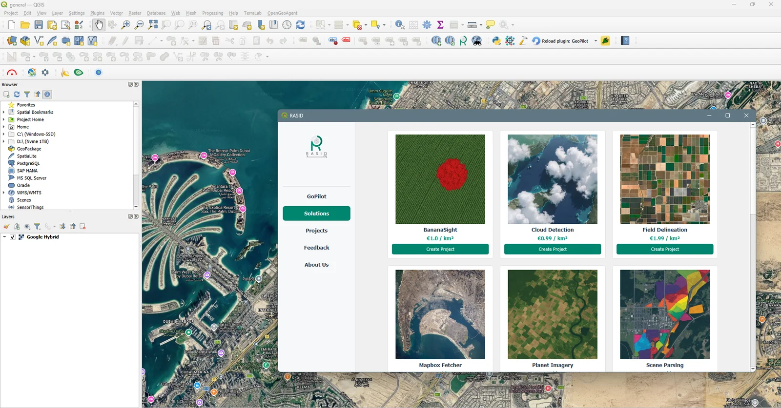
What a user sees is a chat beside a live map. MapUI streams the agent’s reply on one side and draws the layers it produces on the other, so "extract the buildings here" ends as a buildings.shp on the map rather than as a description of how to make one. A tiling server publishes every layer as z/x/y tiles, raster or vector, so large outputs stay responsive. For users who would rather stay in their own tools, GoClient provides SDK and notebook access, and the same agent runs inside QGIS and ArcGIS Pro through RASID plugins.
Storage, logging and cost
One shared Amazon S3 layer holds everything the suite produces: layers, map tiles, documents, embeddings, logs and user sessions. Every component reads and writes the same store, so a result produced by one part of the suite is available to the rest without a copy step. The backend streams metrics and logs to a dashboard that tracks usage and token cost across the whole suite, which is what turns per-request spend into something a client can see rather than an end-of-month surprise.
The result
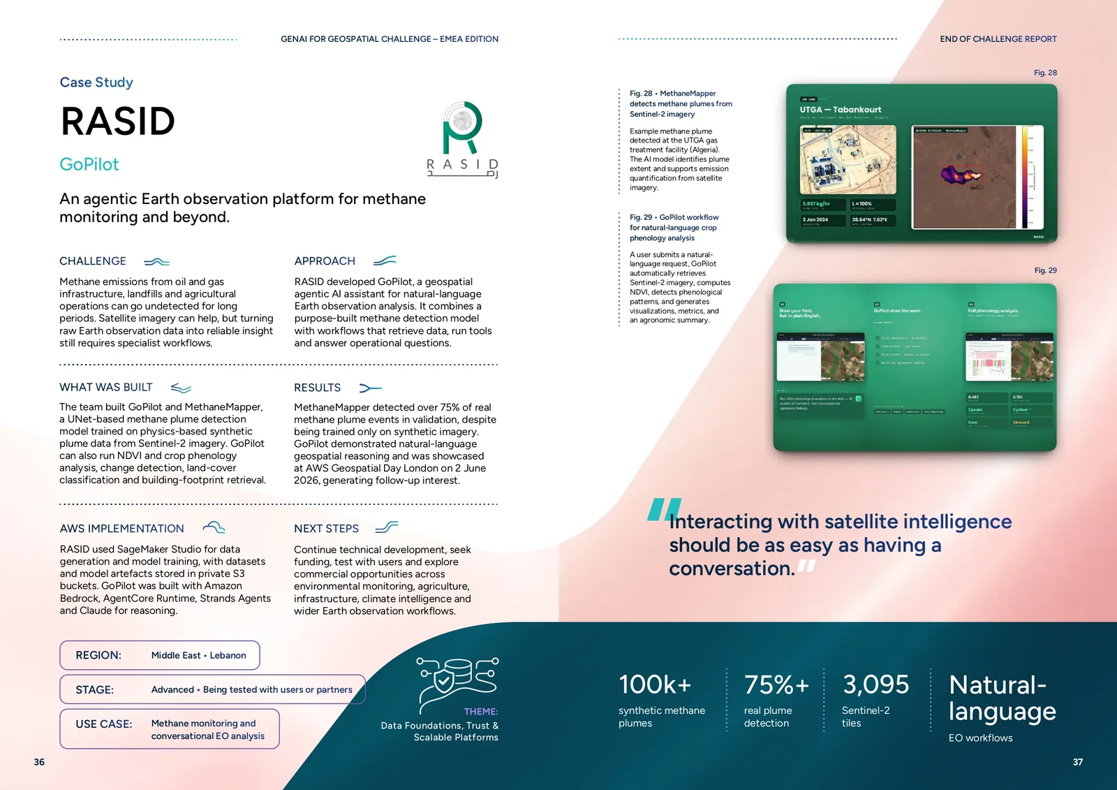
A request such as "extract the buildings in this scene" comes back as a finished layer on the map, backed by cited sources, with the cost of the request visible in the dashboard. Loading only the tools a task needs cuts that cost by 65 to 99%. GoPilot won the AWS Geospatial GenAI Challenge in 2026, and the platform runs in production at app.gopilot.earth with separate production and beta environments, continuous deployment and monitoring. It is commercialised through subscriptions and is also the foundation RASID builds bespoke geospatial projects on.