Selected work.
A decade of funded, delivered projects: the problem, the approach, and the result. From landfill methane detection to an award-winning AI geospatial agent.
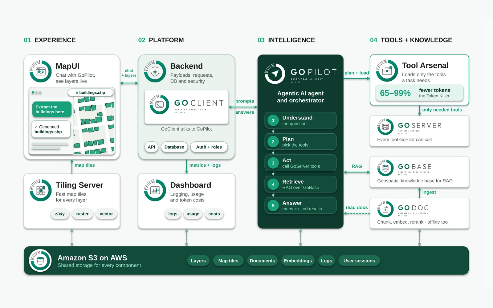
GoSuite: One Agent, Every Tool
RASID’s end-to-end agentic platform: GoPilot plans the work, GoServers supply the tools, GoBase supplies the knowledge and GoDoc parses the documents, with only the tools a task needs loaded into each request.
Read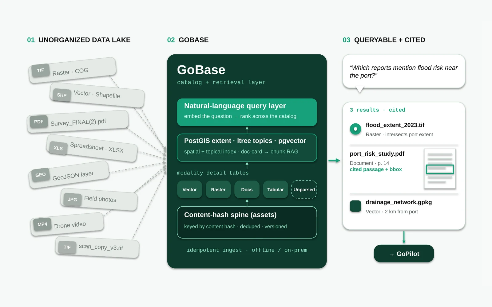
GoBase: A Queryable Catalog for Data Lakes
A catalog and retrieval layer that indexes an entire data lake, raster, vector, documents, spreadsheets, images and video, into one queryable spine with a natural-language layer on top.
Read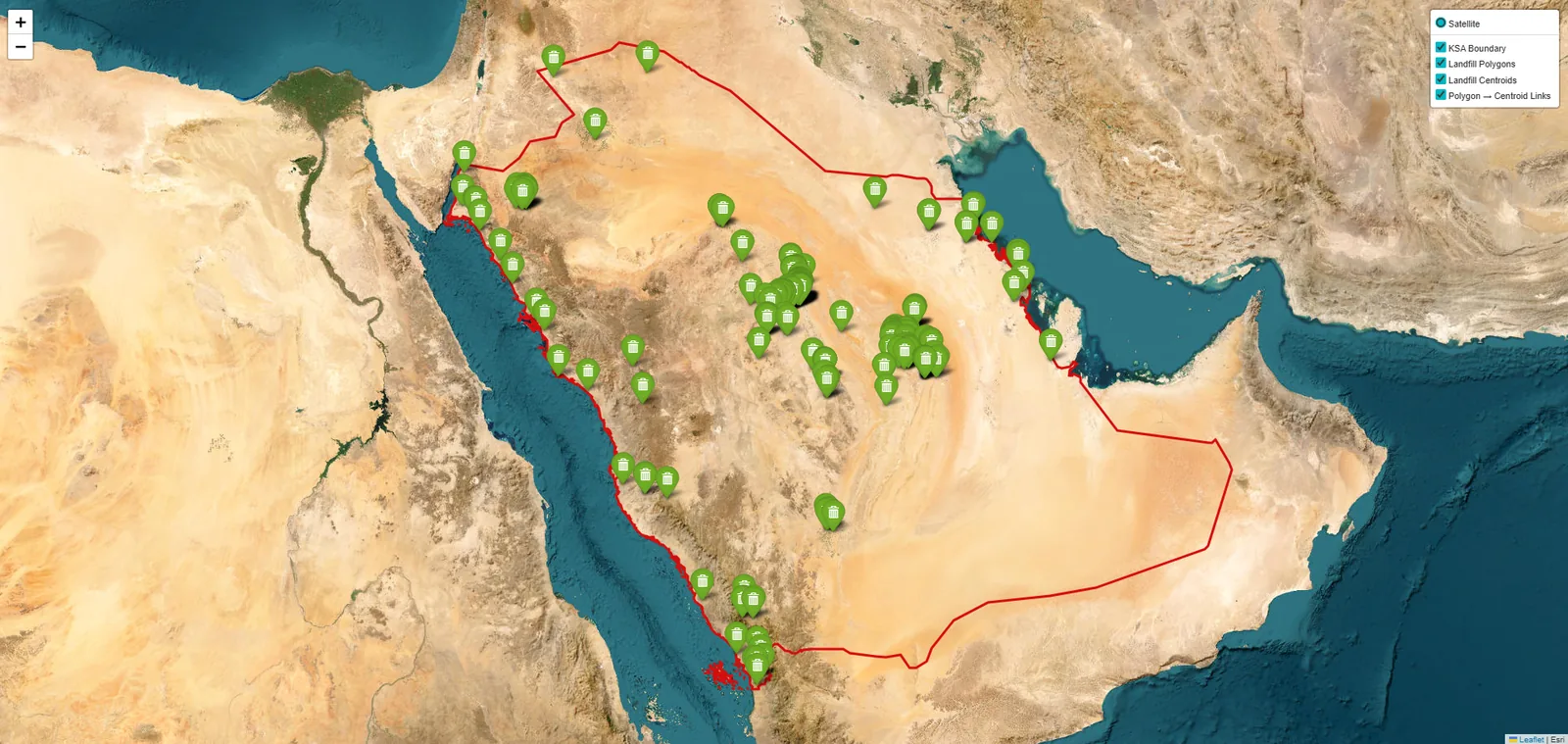
MethaneMapper: Monitoring Methane Plumes from Space
A physics-informed methane detection system that combines Sentinel-2 imagery, synthetic plume generation and deep learning to identify potential methane emission sources from space.
Read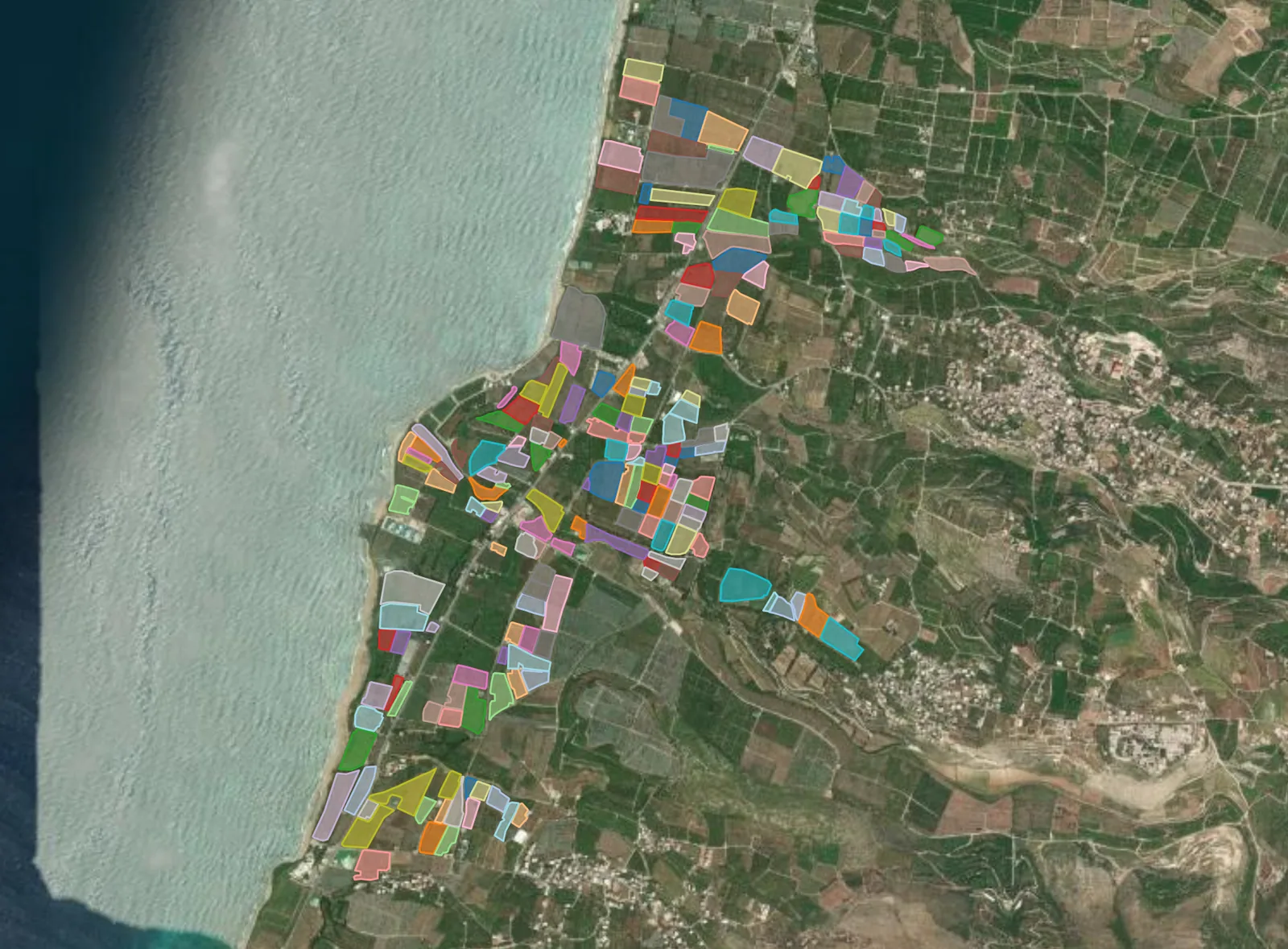
BananaSight: Satellite Early Warning for Fusarium Wilt TR4
A Sentinel-2 monitoring system that learns the banana growth cycle across 713 annotated Lebanese fields and flags stressed plants, including Fusarium wilt TR4, so growers can target inspection before damage becomes irreversible.
Read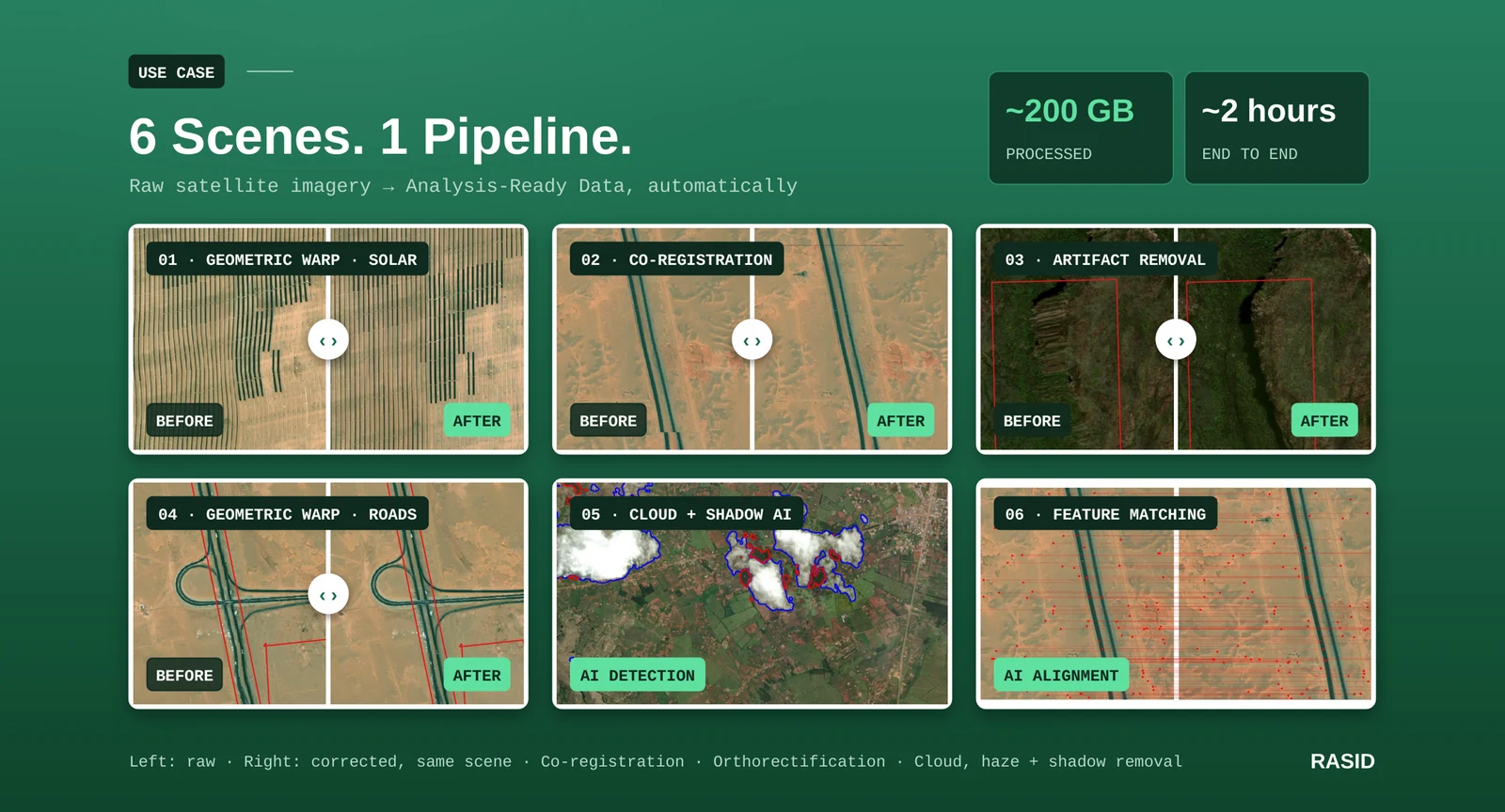
C-ARD: Raw to Corrected Analysis-Ready Data
An AI pipeline that automatically corrects geometric distortion, radiometric inconsistency and cloud, haze and shadow in high-resolution satellite and aerial imagery, processing around 200 GB in about two hours.
Read