MethaneMapper: Monitoring Methane Plumes from Space
A physics-informed methane detection system that combines Sentinel-2 imagery, synthetic plume generation and deep learning to identify potential methane emission sources from space.
Methane · Satellite Monitoring · AI
The problem
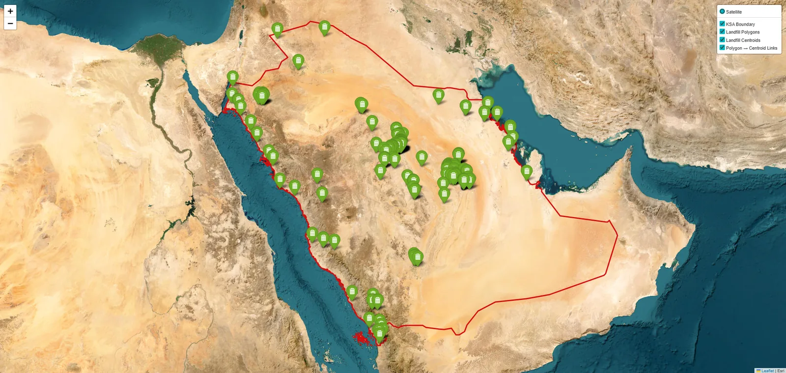
Methane is a powerful greenhouse gas, but identifying individual emission sources over large areas remains technically difficult. Satellite imagery is increasingly available, yet turning an observation into a credible methane detection requires appropriate scene selection, atmospheric information, temporal comparison and specialised machine-learning models.
The approach
RASID developed MethaneMapper, a specialised deep-learning model for methane plume detection from satellite imagery. The workflow uses Sentinel-2 Level-1C imagery as a primary data source and combines spectral information with temporal reference observations to distinguish potential methane plumes from persistent surface features.
The methane detection model
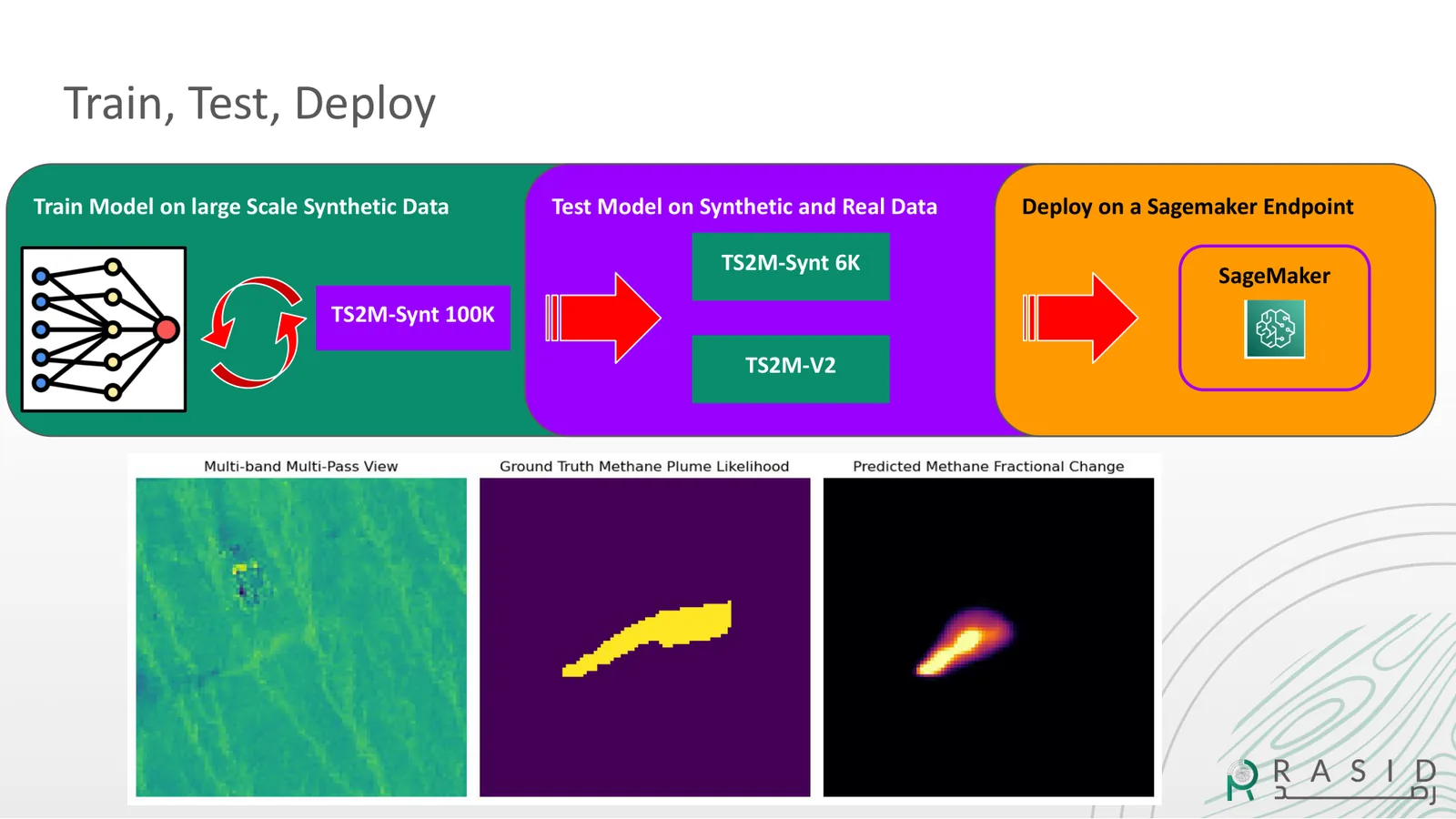
MethaneMapper uses a U-Net-based segmentation architecture to identify spatial patterns associated with methane plumes in Sentinel-2 imagery. The model is trained using both physics-informed synthetic data and confirmed real-world observations, allowing the system to learn from a much larger set of controlled plume examples than is available from confirmed satellite detections alone.
Physics-informed synthetic data
Confirmed methane plume observations are scarce, so RASID developed a synthetic-data pipeline to generate realistic methane plumes and insert them into real Sentinel-2 scenes. The pipeline combines radiative-transfer modelling with a Gaussian puff plume simulator and atmospheric information, including wind data, to produce more than 100,000 synthetic methane plume samples for model development and testing.
Detection workflow
The workflow begins by identifying suitable Sentinel-2 observations for the area of interest. The system then retrieves the imagery, applies the methane detection model and compares the target observation with reference dates. Potential plume signatures are mapped and located, while contextual information can be used to investigate whether the detected signal is associated with infrastructure or another potential emission source.
Detection and confirmation
Each potential detection is evaluated against reference observations so that fixed surface features are less likely to be interpreted as methane plumes. The resulting detections can then be compared with independently confirmed methane observations for validation. This separates the automated detection stage from external confirmation and reduces the risk of presenting every model output as a confirmed emission.
Validation
The detector was benchmarked against the UNEP Eye on Methane dataset of independently confirmed methane plume events. The current detector recovers 80% of confirmed plume events in the validation set. These results are being prepared for scientific publication.
From MethaneMapper to GoPilot
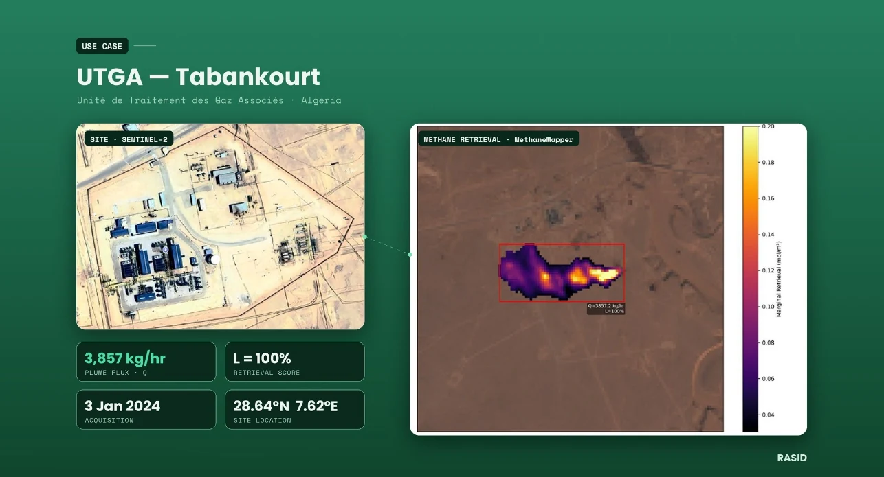
MethaneMapper provides the specialised methane detection capability, while GoPilot provides the agentic orchestration layer. A user can submit a methane-monitoring request in natural language; GoPilot identifies suitable observations, retrieves the imagery, selects and runs the methane workflow, and returns a mapped potential plume. The result can then be contextualised using infrastructure, land cover and historical observations.
Operational performance
The end-to-end workflow, from scene selection to a mapped potential plume, can be completed in minutes. This replaces a multi-step specialist workflow involving imagery discovery, data retrieval, model execution and interpretation with a repeatable agentic workflow that can be initiated through a natural-language request.
Geographic validation
The methane workflow has been tested against confirmed emission events from locations in different geographic and environmental conditions. This provides a basis for assessing whether the detection approach can generalise beyond a single prepared monitoring site or environmental setting.
From detection to mitigation
The next stage is to connect satellite-based detection with operational action. RASID is developing pilots with environmental authorities and oil and gas operators to identify potential emission sources, support field verification and track changes after intervention. Additional sensors and detection models will extend coverage toward continuous regional monitoring and automated alerts.
The result
MethaneMapper has evolved from a specialised methane detection model into a component of GoPilot’s broader Earth-observation agent. The combination of physics-informed synthetic training data, real satellite observations, independent validation and agentic orchestration provides a foundation for scalable methane investigation across regions where suitable satellite observations are available.